- Home
- Environment Baselining Pilot
Environment Baselining Pilot
A pioneering pilot aiming to assess the environmental impact of farms across Great Britain.
This AHDB-driven initiative, with support from QMS in Scotland, is more than a pilot, it is a movement to redefine:
- How farmers are recognised for delivering both food and environmental goods
- The environmental impact of GB agriculture
- The scale and potential of natural carbon stocks and sequestration
- The industry’s progress towards net zero
It aims to:
- Provide the industry with accurate on-farm environmental data, reducing reliance on national and international averages
- Demonstrate the critical role GB agriculture plays in reducing greenhouse gases, building carbon stocks, enhancing soil health and supporting biodiversity
- Enable farmers to take insight-led action towards a more sustainable future

Latest project updates
What’s being measured and assessed?
- Carbon stocks: Carbon above ground in the trees and hedges, and below ground in the roots and soil, will be measured on a range of different farms, including woodland and non-farmed areas. This will also provide an indication of the sequestration potential - the ability to capture, secure and store carbon
- Net carbon position: A carbon audit will review the balance of a farm business’s greenhouse gas (GHG) emissions against its carbon removals and sequestration, providing an estimated net carbon position for the farm
- Run-off risk: the pilot will also deliver a run-off risk map from the measurements taken
These measurements will provide a baseline of each of the 170 farm’s environmental credentials and a starting point for tracking changes over time. We are aiming to remeasure in year five of the project, allowing improvements to be measured, reported and recognised.
On-farm measurements
The first measurement phase was to collect data on above ground carbon stocks in trees and hedges, as well as from the below ground biomass, i.e. the roots. It began in December 2024, with specialist contractor Bluesky carrying out light detection and ranging (LiDAR) scans via planes and drones over a four-month period whilst the leaves were off the trees.
Aerial LiDAR scanning uses laser technology to measure the height of the terrain and any above-ground features, such as hedges and trees, and is far more accurate than satellite scans.
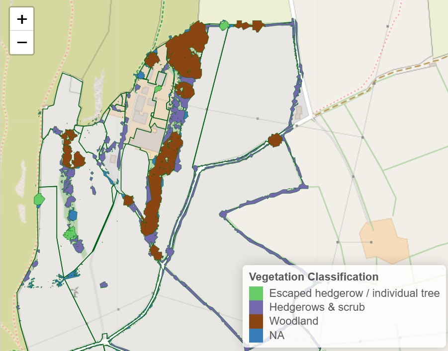
Trinity Agtech runs this LiDAR data through specialist software to build a 3D model for each farm. This interactive image identifies objects like buildings, field boundaries and woody biomass – giving precise heights, widths and densities of vegetation.
When combined with information from satellite imaging and species identification, the software can calculate the amount of carbon stored across the farm and identify which areas are the key carbon stores.


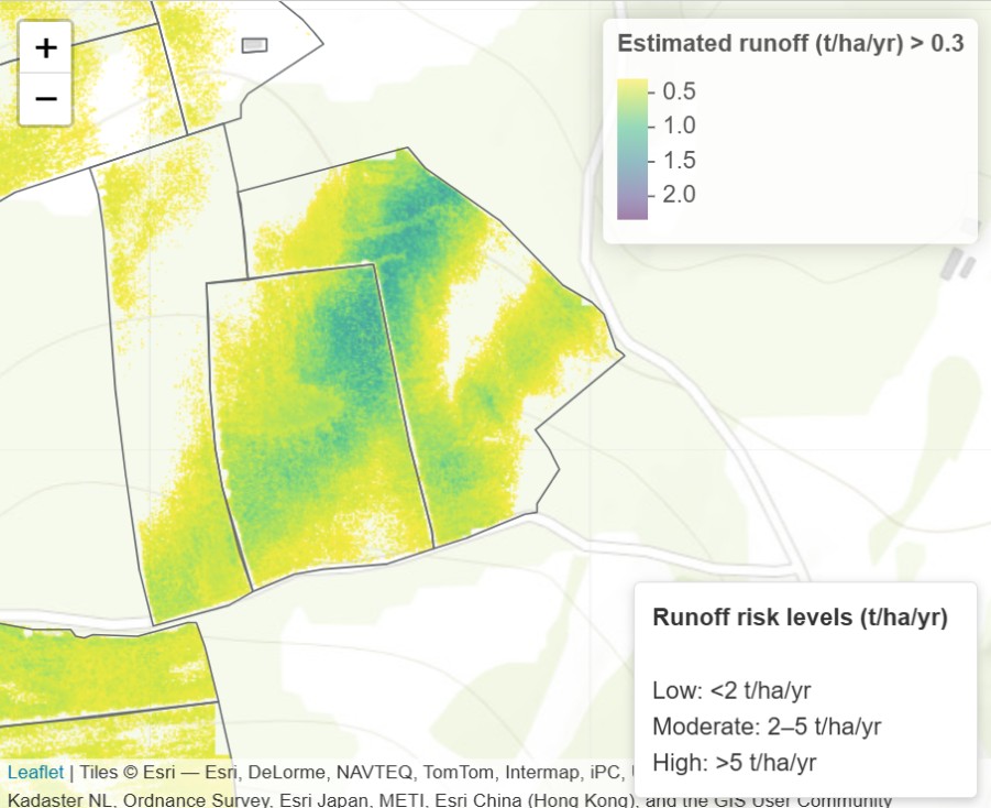
Carbon stocks in woody biomass are mapped out (left) and areas of run-off risk are identified (right)
As LiDAR scanning maps ground features and terrain, it can be combined with data to identify areas at risk of run-off and guide decisions on reducing soil erosion, buffer zones, drainage plans or nutrient planning to cut pollution risks.
The maps can also highlight where gaps in hedgerows, scrub or tree cover could be connected to create wildlife corridors and larger habitats, greatly enhancing their value
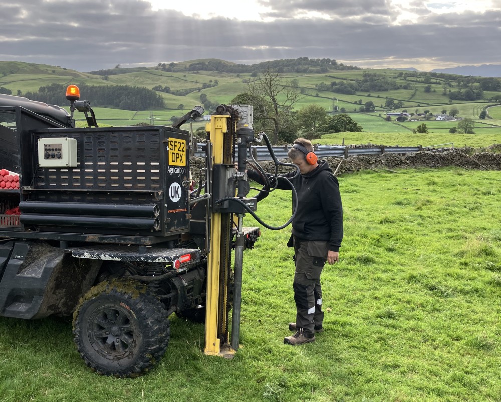
The second phase of measurements began in January 2025 and will run till the end of 2025. Specialists Agricarbon are using vehicle-mounted core samplers and taking soil cores from various depths down to 1 metre, or the C horizon.
This enables a better understanding of where soil organic carbon is stored and allows the impact of cropping and management practices to be tracked with subsequent sampling.
In less accessible areas like woodland, marshes and dense vegetation, hand corers will be used to depths of about 60 cm.
Nutrient sampling is also being carried out around the cores and the results will be mapped to allow samples to be taken from the same point when remeasurements take place at a later date.
Vehicle-mounted core samplers take soil to a depth of 1 m
This third phase began in June 2025 and will continue until October 2025.
Each farm has a carbon audit to assess greenhouse gases emissions and estimate carbon sequestration/removals. The balance between these two metrics will provide an estimated net carbon position for the farm.
Audits are being undertaken in years one, three and five of the pilot using Agrecalc, supported by consultants from ADAS or SAC Consulting to ensure accuracy and consistency.
Farmers will develop and agree an action plan based on their results in years one and three outlining steps they can take to improve the environmental sustainability of their farms. This will be reviewed as the pilot progresses.
Find out more
Frequently asked questions about the baselining pilot
If you have any questions email environment@ahdb.org.uk
You can find out more about the work we do for levy payers by visiting our environment page.


